| << Prev | Intro | Day 1 | Day 2 | Day 3 | Day 4 | Day 5 | Day 6 | Day 7 | Day 8 | Day 9 | Next >> |
Day 2, Friday, June 9 - Cross Bay to Frost Lake
At the time we reserved our bunkhouse, we also signed up for the French toast breakfast offered at the lodge. Even though we had a long first day of paddling planned, we decided a good send-off breakfast would be more important than getting a really early start. So we head over to the dining building right at our scheduled 7:00AM time and join a few other groups who are also just starting their day. One group has a younger member who is about to enter the boundary waters for his first time. Some of the older, more experienced members of the group are getting him all worked up about their trip, and the younger boy's excitement becomes tangible and contagious. Heidi and I polish off our delicious breakfast and ride that air of enthusiasm out the door and all the way to our boundary water's entry point.
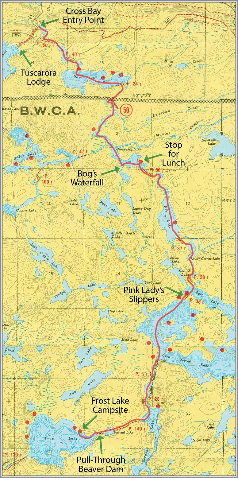
The Cross Bay entry point parking area is just off of County Road 47, about halfway between the Gunflint Trail and Round Lake. The lot can probably hold one or two dozen vehicles, and a short stairway descending down from there leads to the boat launch. The lake at this entry point is the first of two small unnamed lakes branching from the Cross River that eventually lead to Ham Lake. All three of these lakes and the three portages connecting them are officially outside of the BWCAW border, but you'd never know that if it weren't for the signs. All of them share the trademark beauty of the boundary waters, and Ham Lake itself has four designated campsites that could make for a good launching point for anyone arriving late in the day or for those who prefer a campsite over a bunkhouse. A short 24 rod portage beyond Ham connects you to Cross Bay Lake and the official boundary waters.
Back at the boat launch, as we are loading the last of our gear into the canoe, we are joined by a group of four young men with two canoes. They are heading to Long Island Lake for some fishing and are traveling very light in comparison to us. They seem to be hauling nothing more than the clothes on their back and some fishing rods. I look over at our bulging Duluth Packs and large camera bag and determine we still have a way to go in paring down our gear. Each time we go, we seem to bring half as much stuff as the time before, and yet it's still twice as much as we really need. I don't think we'll be quite so bad on this trip, but there will definitely be room for improvement when we plan our next boundary waters outing.
When the group of four learn we are doing a loop through the Frost River, one of them reveals that they've also done this very same trip in a previous year. He continues to say it was a very tough route that left little time for fishing or relaxing, a mistake they would not be making on their current outing. Another member of the group goes into more detail about the tough portaging we face but also says the scenery and seclusion are worth it. He finishes by singling out one portage in particular that is a real beast due to its very steep ascent and even more vertical descent. I have a feeling, from trip reports I had read, that he must be referring to a portage near Afton Lake, located at the west exit of the Frost River. For a moment, I consider the younger age and better conditioning of these clearly more experienced canoers and wonder if Heidi and I are really ready to take this big of a bite out of the boundary waters. That moment doesn't last long, though. We weren't going to learn the answer to that question sitting on the boat launch, so we carefully shove off and head across the short stretch of lake to our first portage.
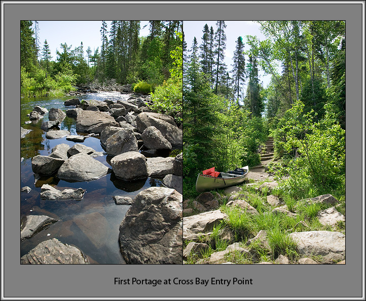
Within minutes, we are already arriving at the rocky landing of the first portage, a well beaten 50 rod trail leading to the next small lake. To the left of the portage is a rapids, obstructed a little further up river by some tree debris. The portage itself, led by a series of wooden steps, disappears up a slight hill. We are just beginning to remove our packs when the group we met at the landing catches up with us. Even though we will share much of the same route today, it's obvious that they will be moving considerably faster than us, so we let them go on ahead while I take a few pictures.
After the group of four leaves with their last load, I notice another larger group with four canoes starting to gather back at the boat launch. The Cross Bay entry point only has three daily overnight permits in its quota, so it would appear we're all on similar schedules. Heidi and I quickly get ourselves organized and head off over the portage. This first series of runs is not very efficient, as we work to find a routine. By the next portage, however, we start to settle into our procedure of unload, double portage, and reload. The unload step entails removing our packs and securing the paddles to the canoe thwarts with (you guessed it) Bungee Dealee Bobs. Then I put on my day pack, hoist the canoe on my shoulders and head out. Heidi follows, carrying the waterproof camera backpack and her day pack. We take advantage of the return trip to stop and smell the flowers (literally, in some cases), and on our third time over we each take a Duluth Pack. Finally, with everything reunited on the other side of the portage, paddles are freed and packs reloaded in a colorful flurry of flying BDBs.
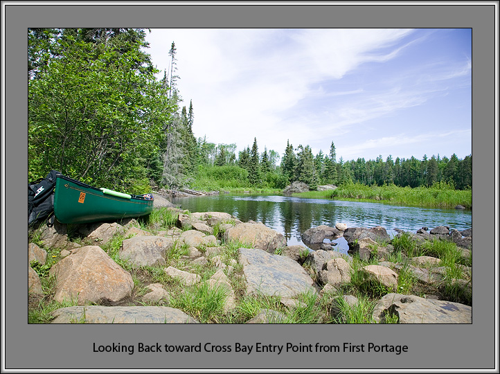
By the time we reach Ham Lake, we're really starting to find our rhythm. I finally relax, feel the breeze and enjoy the scenery on this beautiful sunny day. In many ways, for me, the trip really begins here.
Before long, we're looking for the portage out of Ham Lake, and it doesn't appear to be at the point indicated on our map. I double check with the new GPS unit we bought for the trip, but it also has the portage landing at roughly this same spot. I recall a previous trip report I had read that warned about this, so we paddle along the shore until we eventually locate the portage about 200 yards southwest of where Extortion Creek empties into Ham Lake. On the portage trail, a sign officially welcomes us to the boundary waters. At the other side, Extortion Creek and beautiful Cross Bay Lake greet us with open arms, channels and bays.
Cross Bay Lake is one of those signature boundary waters lakes that so many paddlers love. Its dark waters snake their way through narrow channels of rocky outcroppings and rough forest, opening up to the occasional creek at marshy bays filled with reeds and water lilies. The ragged and un-manicured shoreline emphasizes that you're traveling through wilderness country now.
Toward the southern end of the lake, we go looking for and find a pretty waterfall recommended to us by Bogwalker, an experienced paddler from one of the indispensable online boundary waters websites. We admire the waterfall from the lake through one of the few windows in the brush we can find, but unfortunately we can't locate a good place to land the canoe for a closer look.
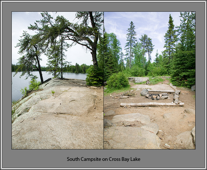
On the opposite side of the lake from Bog's waterfall sits Cross Bay's southern-most campsite. Heidi and I decide to stop there for some lunch and to take some photos before moving on. The campsite is a really nice one, high up on a rock ledge overlooking the lake and in view of our next portage to Rib Lake. While eating, we realize that we're traveling pretty slow and it's already well past 1:00PM in the afternoon. We'll need to pick up the pace to have any chance of making it all the way to Frost Lake, our intended destination.
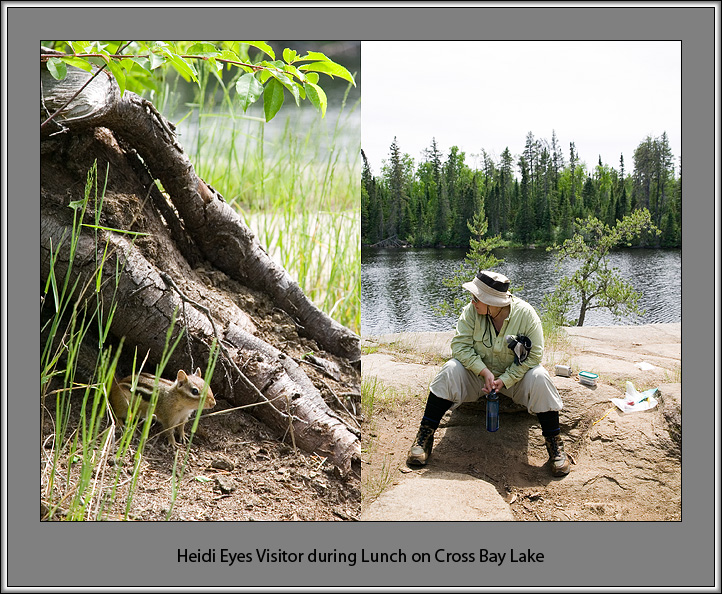
As we're packing up to go, we see a group of four canoes heading for the portage, quite possibly the same group that had been behind us at the entry point. We put down our packs and wait as the group, apparently two families with children, paddle by. It takes a while for the large group to clear the portage, and we start to consider the possibility that we may need to stay somewhere earlier on our route, like maybe Long Island Lake. I'm hoping this will not be the case, since we are planning to spend a layover day on Frost Lake, and this would mean a lot more setting up and tearing down of camp. So after the last canoe jumps up and disappears into the trees, we quickly set off for the portage landing.
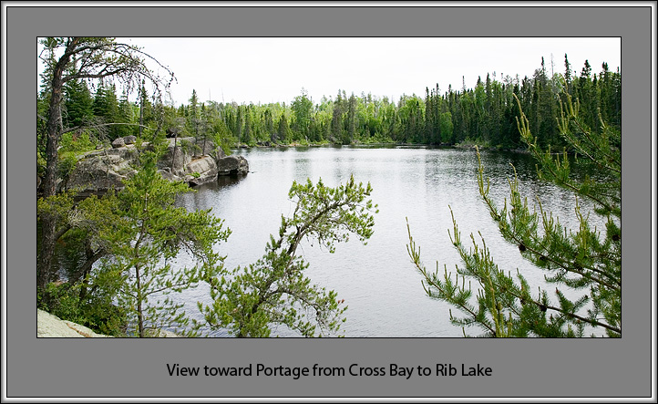
From this point, we start to make better time, but the day is also passing quickly. On Rib Lake we discover that the large family group has taken the sole campsite there, which means we luckily won't have to worry about bumping into them again at another portage. On Lower George Lake, at the landing of the portage leading to Karl Lake, our haste results in a half-tipping of the canoe that got Heidi and me good and wet, but thankfully left most of our gear reasonably dry. As it turns out, the unscheduled and unexpected dip actually feels good in the day's afternoon heat, and it helps add an extra spring to our step.
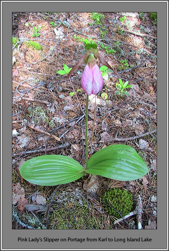
Once on Karl, we now have a choice as to how we reach Long Island Lake. We could take the short 35 rod portage over the northern stem of Long Island's large central land mass, or we could instead avoid the extra portage and paddle an extra mile around the mass. Hoping to make up some time, we choose the portage and are rewarded. Shortly after huffing and puffing up the portage's steep ascent with the canoe, I see a flash of pink hit the corner of my eye. Upon closer inspection, it turns out to be a pink lady's slipper. On our return trip across the portage we take a longer look and find dozens of the strange yet beautiful flower scattered all over the portage. For Heidi and me, this is an exciting find. I had never seen one of these before, and we had both spent time looking for them on previous trips. Supposedly they were blooming earlier than usual this spring, which may explain why we had missed them before.
The evening sun is now getting noticeably low as we slide into big Long Island Lake from the rare, but all too welcome sandy beach landing at the end of the portage from Karl. Still three or four portages away, Frost Lake is said to have a number of these rare boundary waters sand beaches, but we won't be seeing any of them today if we don't keep moving quickly. We both begin paddling with some renewed vigor toward the Long Island River, which flows into the lake at its southwest corner. This waterway will connect us with Gordon Lake where we will make a right turn west toward Frost Lake and the beginning of the Frost River system.
It is a beautiful evening, and we see a number of canoes on the water with fishing poles extending out over their sides. I suggest to Heidi that the group of four from this morning are likely among those happy fisherman out there basking in the golden sunshine, having found their boundary waters paradise this evening. We discuss stopping here for the night, but I gently push for us to move on in hopes of finding our own slice of paradise on the Frost River. We agree that if it gets too dark or we become too tired, we might be able to stop at the one lone campsite on Gordon Lake, assuming it's not already occupied.
It isn't long before we find the Long Island River opening and leave the bright, wide open lake for the more familiar narrows, now mostly covered in shade and getting dark quickly. The long day finally catches up to us, but we still manage to somehow drag ourselves over the next two short portages and into Gordon Lake. At this point, even I am ready to stop for the night, but as we glide past the one solitary campsite and look to our left, we first see a canoe out in the water and then a tent up on shore. Knowing what we now have to do, we steer our canoe instead to the right and head for the 140 rod portage to Unload Lake and adjacent Frost Lake just beyond that.
Up until this point, Heidi and I had never done a portage over 60 to 70 rods - ever. And after a long first day of nine other portages (also more than we've ever done), it is not the ideal time for our initiation into the 100 rod club. But luckily, the long length of the day offers us just enough light, and with a little second wind and an extra push of adrenaline we manage to grunt out all three trips across the portage. Once on the other side, we are rewarded with high enough water levels to be spared the final portage into Frost Lake. Instead, we push and pull ourselves through what seems like remnants of an old beaver dam, and soon we're following the north shore of Frost Lake looking for the first available campsite.
The sun is setting quickly, so we don't even attempt to cross the lake for the three campsites on the western shore. I'm a little disappointed by this because the sandy beaches and better moose habitat supposedly lie over there. On the bright side, though, the eastern campsites will get the sunsets and the last of the evening light, something we'll no doubt find very useful as we scramble to set up camp.
While passing the eastern-most campsite, we notice that it appears a bit small, enclosed, and faces mostly south. We go a little further to the next site and notice that it faces west, is more open, but is also unfortunately taken. A little disappointed, we double back to the first site only to discover that it's really much bigger and more open than we had first thought. Once past its opening, Cedars and large White Pines create a spacious canopy that shelters a large area carpeted with pine needles. Heidi and I agree that this will be a great place to rest up over the next two nights before venturing further onto the Frost River.
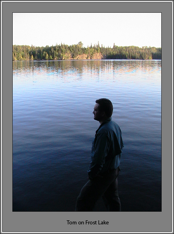
After quickly setting up camp, we settle in by the fire and dig into some freeze dried Chili Mac and pasta. An almost full moon rises across the lake as a beautiful boundary waters sunset concludes a wonderful, yet exhausting first day. Soon after the tree line on the far shore turns to silhouette against the moonlit sky, we drag our weary bones into the tent and easily drift off to sleep.
| << Prev | Intro | Day 1 | Day 2 | Day 3 | Day 4 | Day 5 | Day 6 | Day 7 | Day 8 | Day 9 | Next >> |